
Caldor Fire Aftermath from Hwy 50
I recall driving up to South Lake Tahoe after the fire last year and thinking that it was not as bad as I thought looking at the trees and damage from my view on the road. Driving through now is a different experience. The dead trees are getting cleared and the actual destruction is a lot more visible.
The area is pretty devastated and will probably take a generation if not a lifetime to recover.
The last 30 miles or so up Hwy 50 used to be a pleasant winding green corridor where you could forgive the annoying car in front of you going too slow on the single lane since at least you had a nice view to appreciate (during the day anyway).
Now the scene just reminds you of the fire and it’s slower since the workers will hold traffic and make certain sections single lane one way so they can work on the other side of the road clearing lumber and making repairs.
The world just seems out of balance when just one nutjob can do so much damage and destroy so much by lighting a match, or say when a nutjob can start a land war in Europe.
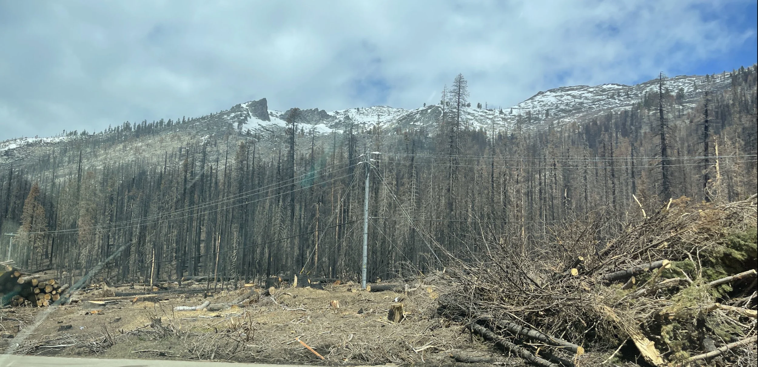
Utility lines that used to be somewhat hidden by the trees are now clearly visible.

Looks like the lumberjacks w
ill be busy for a while clearing the dead trees - it seems like they clear everything uphill of roads and structures in case erosion causes them to fall down. Some hillsides also have the chain link fencing to prevent rockslides since there are no longer trees to anchor the soil and rocks.

Once you get near the basin, most of the view looks like this now along with some burned out homes with just the chimney still standing and a burnt-out car here and there.

Entire swaths of hillsides that used to be green are black now with burned tree trunks.